The recent advancement of generative foundational
models has ushered in a new era of image generation in the realm of natural images,
revolutionizing art design, entertainment, environment simulation, and beyond.
Despite producing high-quality samples, existing methods are constrained to generating images
of scenes at a limited scale. In this paper, we present MetaEarth - a generative foundation model
that breaks the barrier by scaling image generation to a global level, exploring the creation of
worldwide, multi-resolution, unbounded, and virtually limitless remote sensing images.
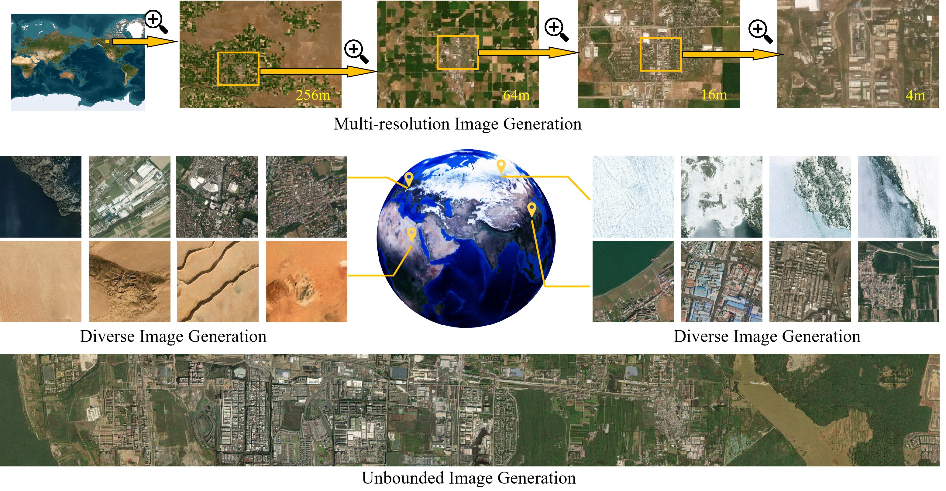
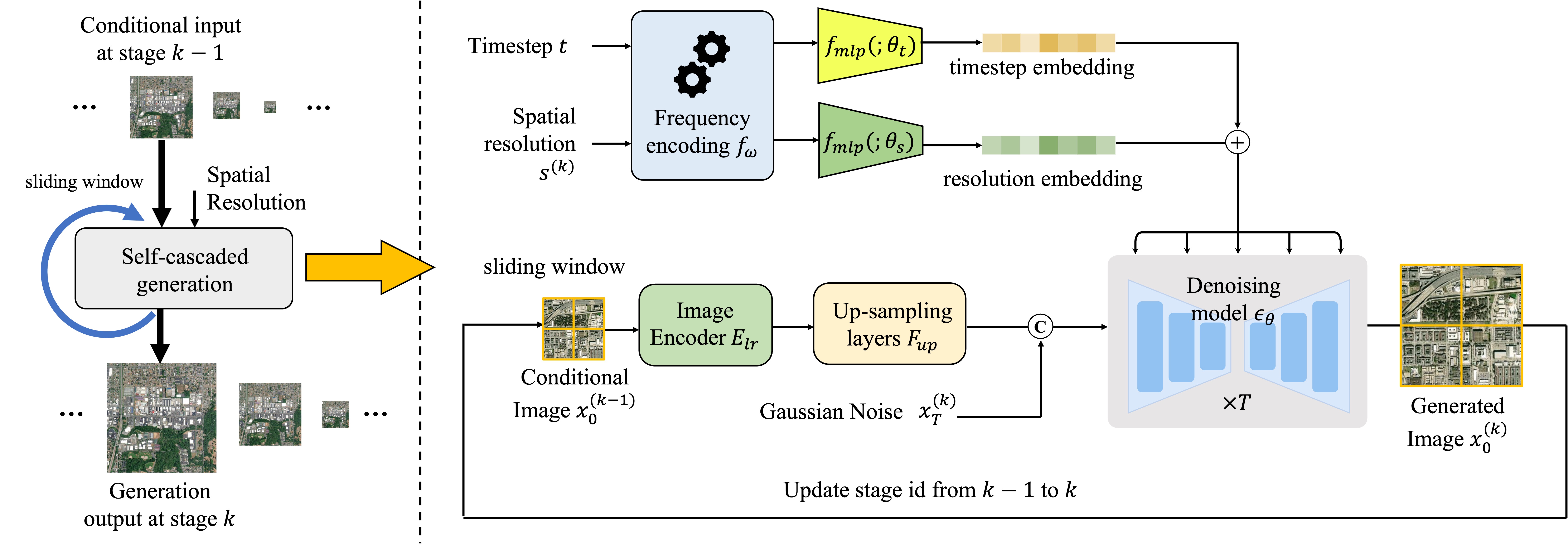
In MetaEarth, we propose a resolution-guided self-cascading generative framework,
which enables the generating of images at any region with a wide range of geographical resolutions.
To achieve unbounded and arbitrary-sized image generation, we design a novel noise sampling strategy
for denoising diffusion models by analyzing the generation conditions and initial noise.
To train MetaEarth, we construct a large dataset comprising multi-resolution optical remote sensing
images with geographical information. Experiments have demonstrated the powerful capabilities of
our method in generating global-scale images. Additionally, the MetaEarth serves as a data engine
that can provide high-quality and rich training data for downstream tasks. Our model opens up
new possibilities for constructing generative world models by simulating Earth’s visuals from
an innovative overhead perspective.
We constructed a world-scale remote sensing generative foundation model
with over 600 million parameters based on the denoising diffusion paradigm. We propose a
resolution-guided, self-cascading framework capable of
generating scenes and resolutions for any global region. The generation process unfolds in
multiple stages, starting with low-resolution images and advancing to high-resolution images.
In each stage, the generation is conditioned on the low-resolution images and their associated
spatial resolutions generated in the preceding stage.
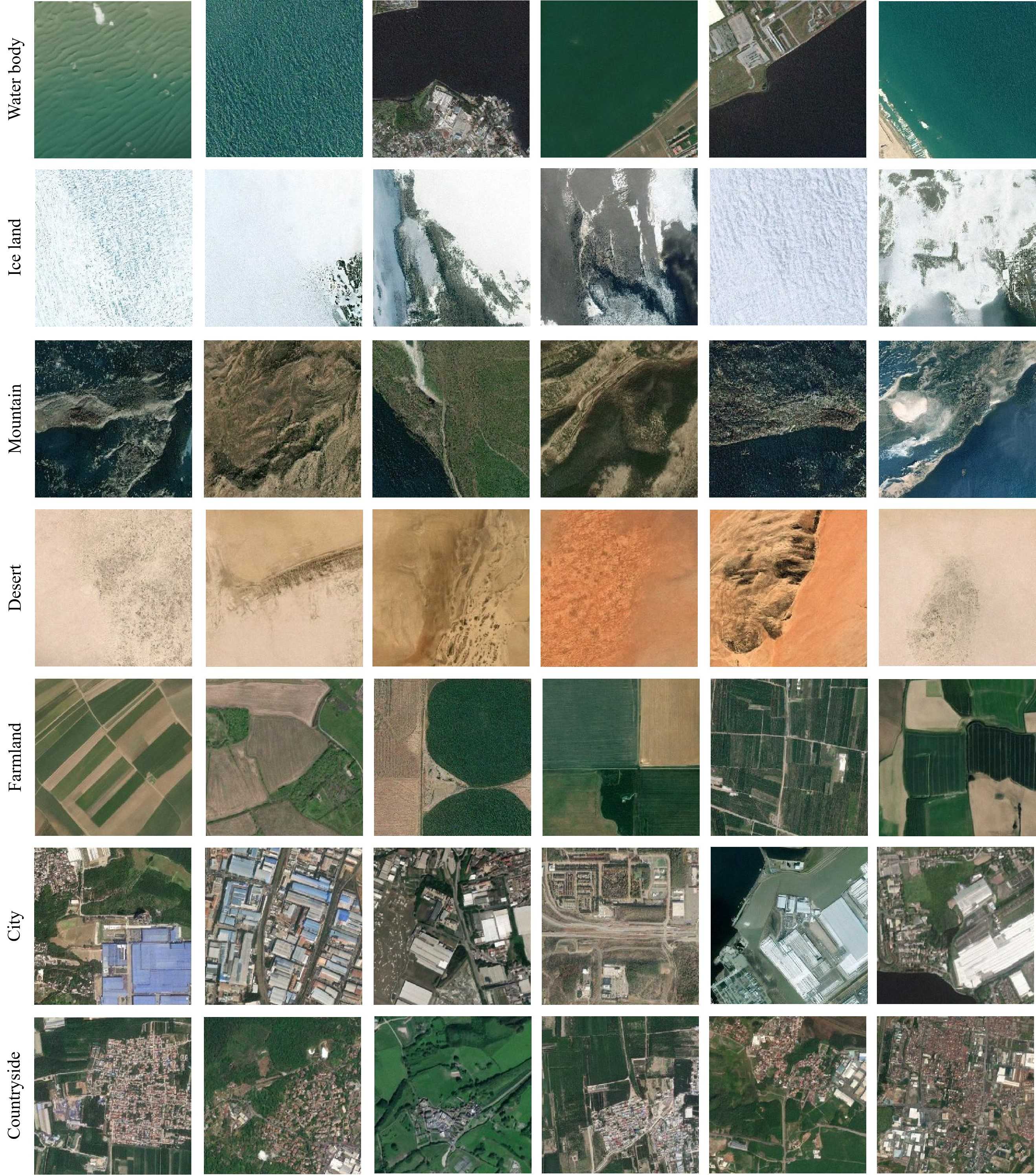
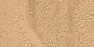
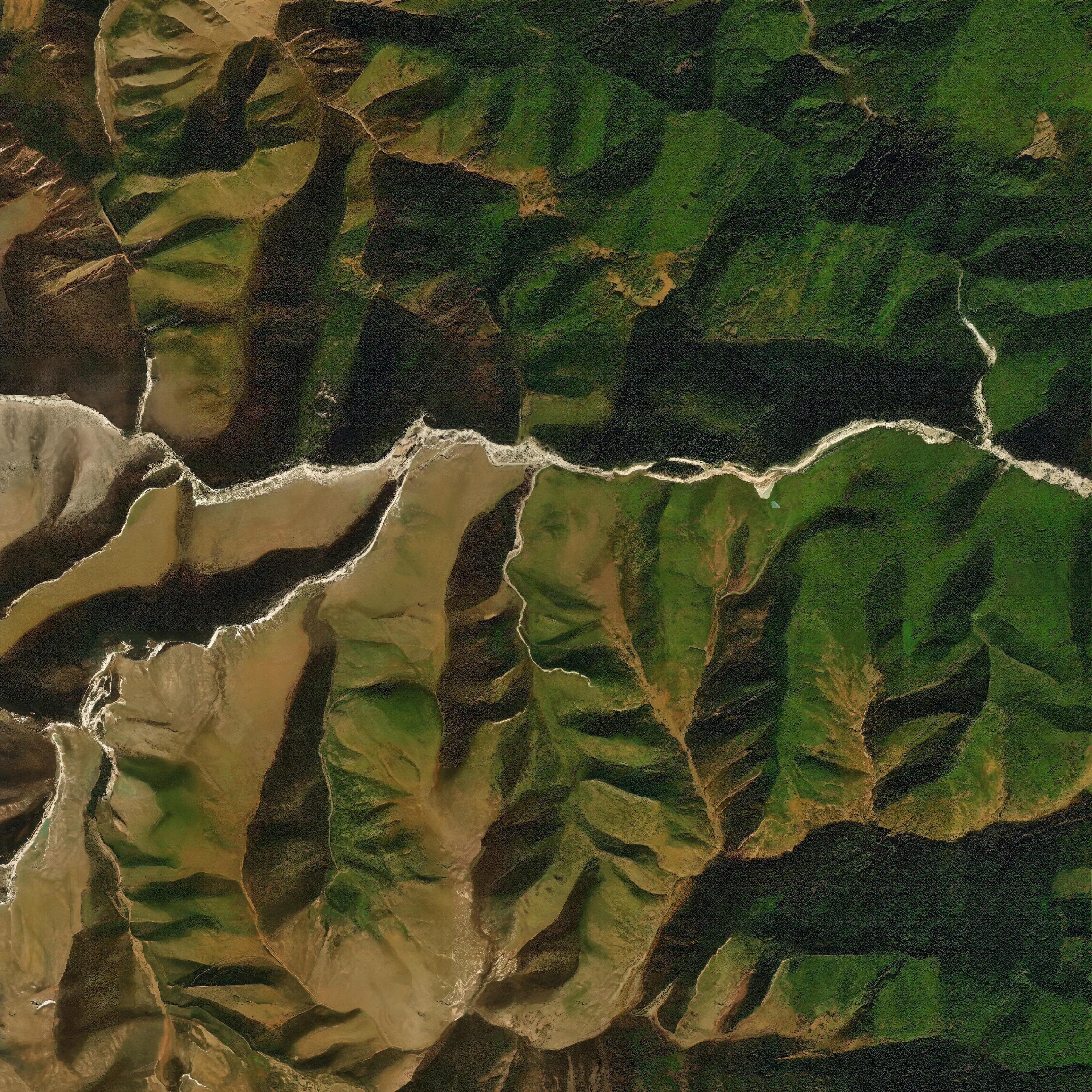
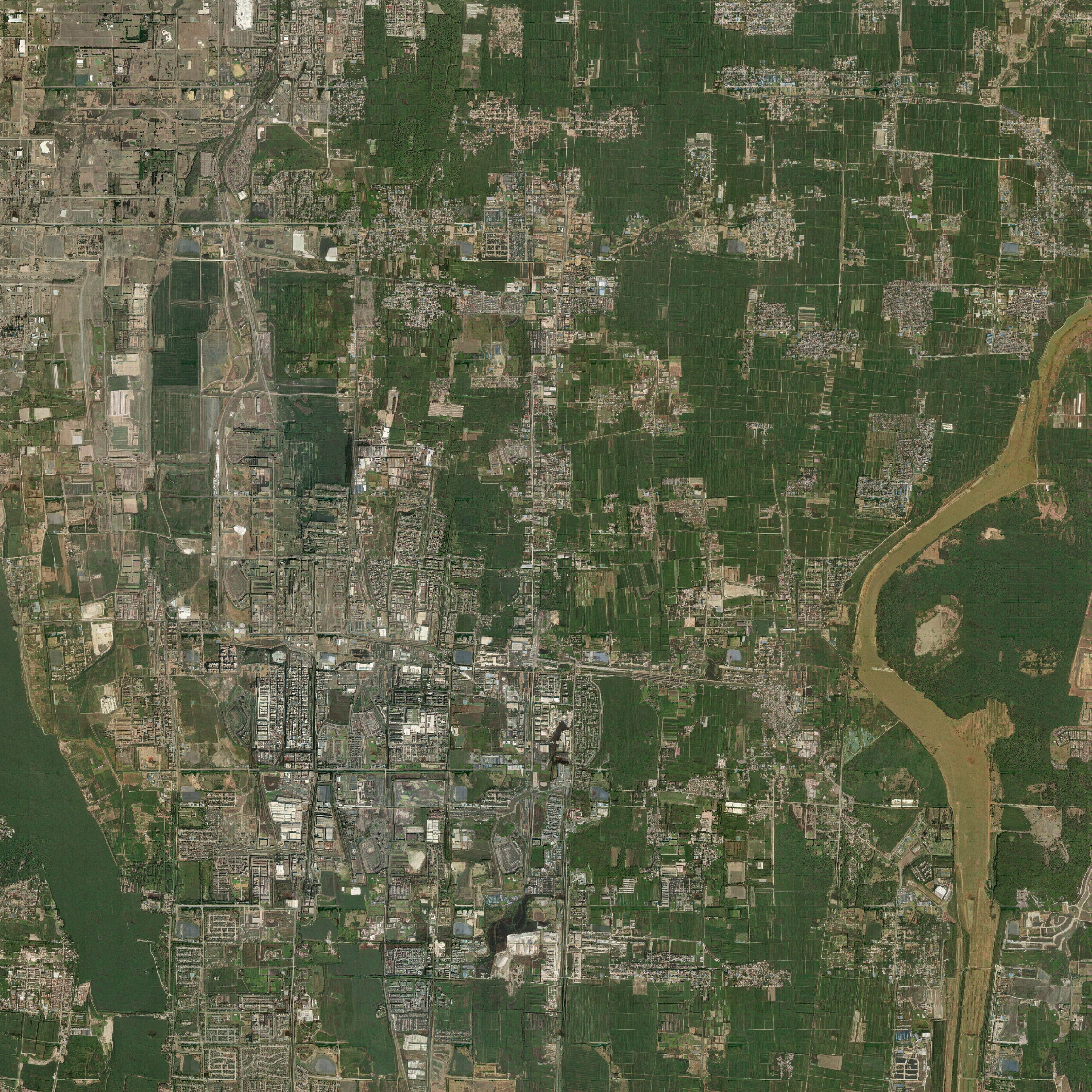
Our MetaEarth can generate a variety of remote sensing scenes worldwide,
including glaciers, snowfields, deserts, forests, beaches, farmlands,
industrial areas, residential areas, etc.
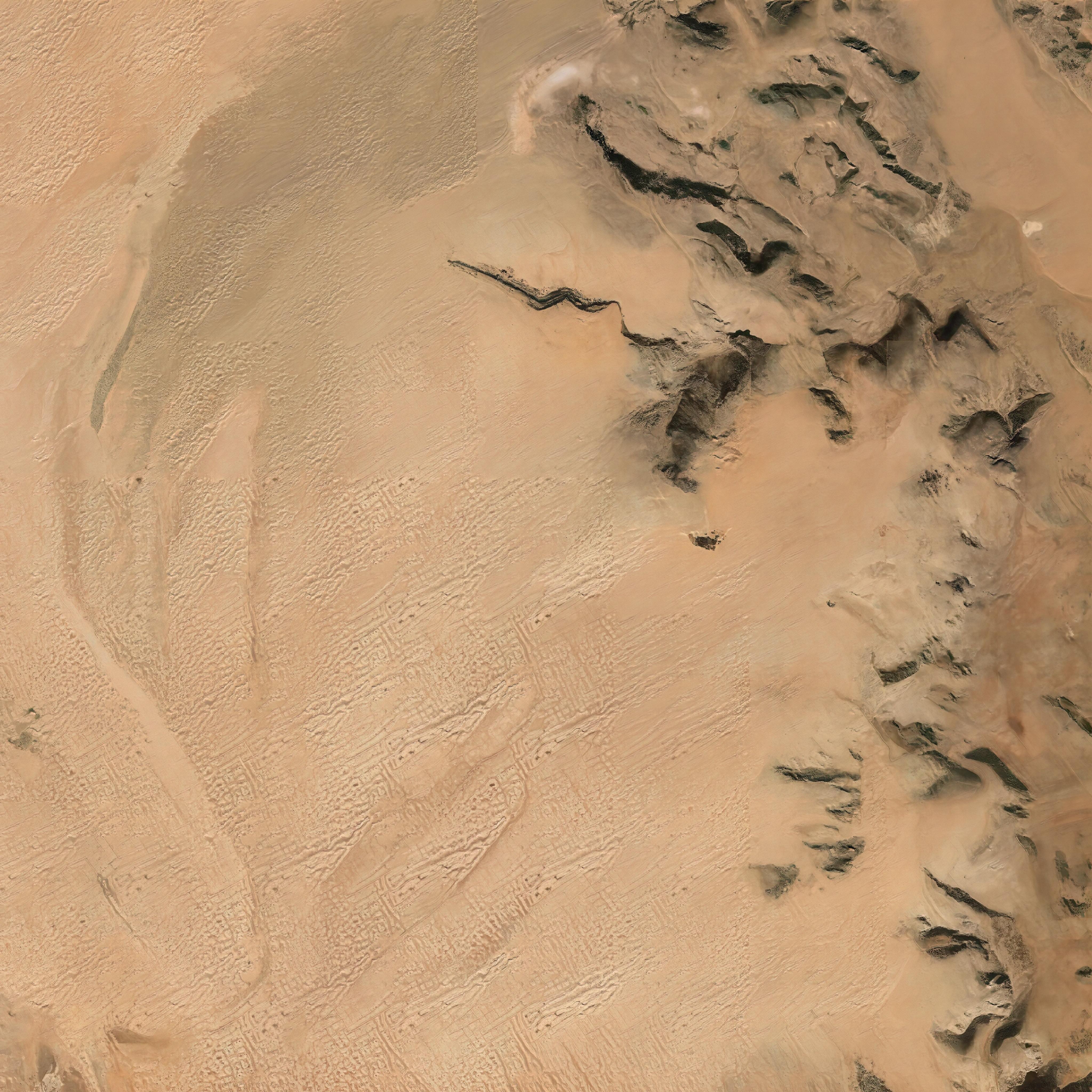
To achieve the generation of large-scale remote sensing images
of arbitrary sizes, we propose an unbounded image generation method including
a memory-efficient sliding window generation pipeline and a noise sampling strategy.
Our proposed unbounded method can greatly alleviate visual discontinuities caused by
image block stitching, thereby achieving boundless and arbitrary-sized image
generation.
Here are some examples of high-resolution large-scale images
generated by our model (click to view the original sized images).
The self-cascading generation framework in our method enables the model to generate
images with spatial resolution diversity.
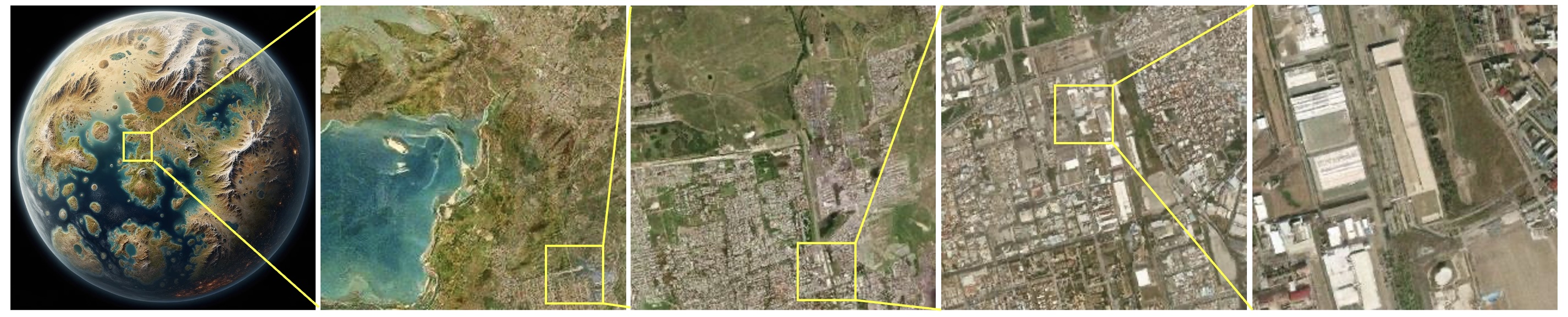
Thanks to being trained on large-scale data, our MetaEarth possesses
strong generalization capabilities and performs well even on unseen scenes. We create a
"parallel world" and use a low-resolution map of "Pandora Planet" (generated by GPT4-V) as the initial
condition for out model and then generated higher-resolution images sequentially. Despite our
training data not covering such scenes, MetaEarth is still able to generate images with reasonable
land cover distribution and realistic details.
@inproceedings{yu2024metaearth,
title={MetaEarth: A Generative Foundation Model for Global-Scale Remote
Sensing Image Generation},
author={Zhiping Yu, Chenyang Liu, Liqin Liu, Zhenwei Shi, Zhengxia Zou},
year={2024},
journal={arXiv preprint arXiv:2405.13570},
}